Erosion and Natural Hazards
The fluvial system is a collection of connected landscape elements (hillslopes, channels, river network) that evolve in response to climate forcing and land surface conditions to produce dynamic sediment fluxes. In our research on fluvial systems, we focused on aspects of the sediment storage-release problem by physically-based and conceptual modelling, and the hydrological triggering of natural hazards that leads to sediment production at catchment scales (e.g. by landslides).
Distributed sediment pathway modelling

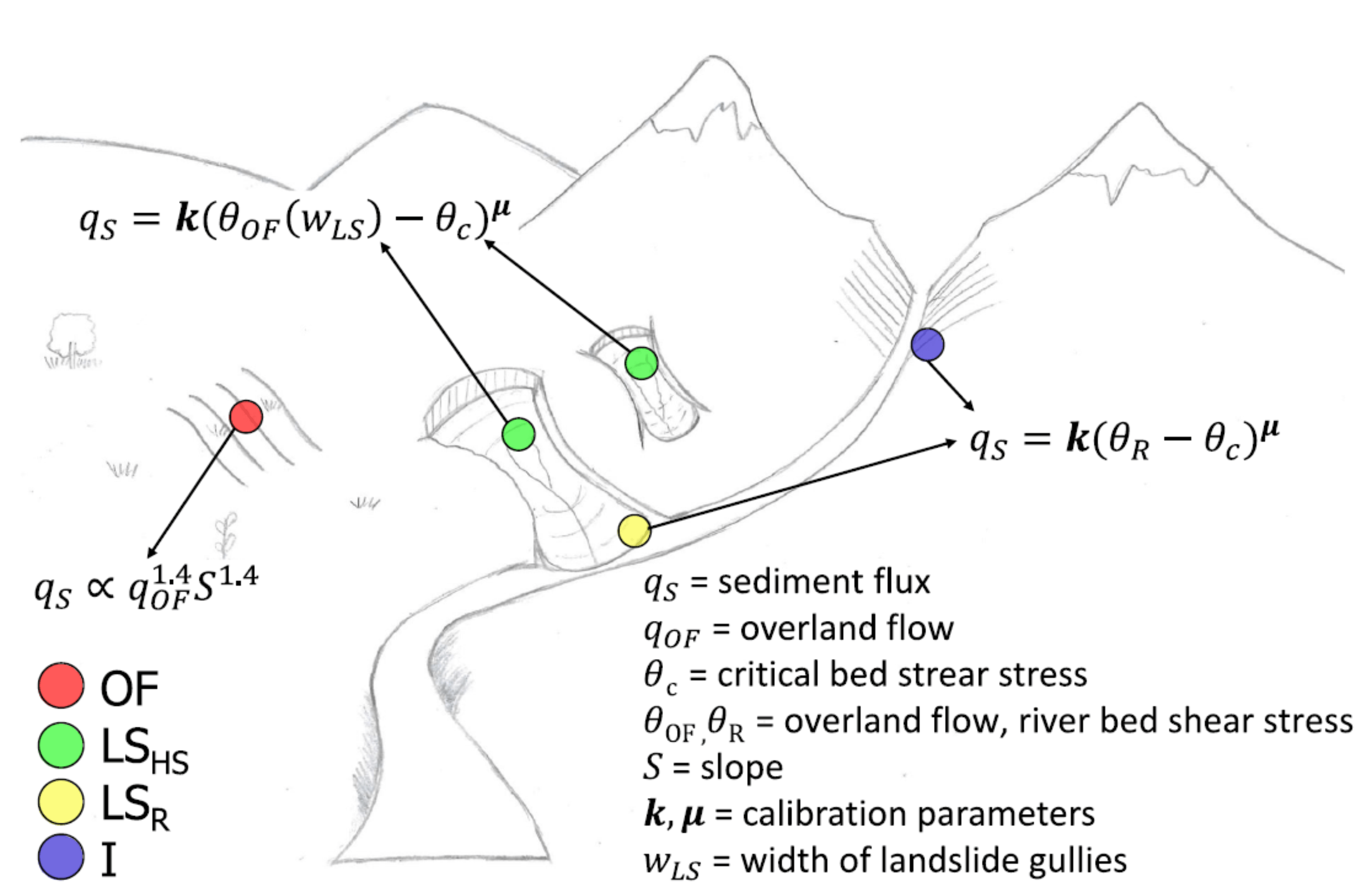
Physically-based fully-distributed modelling of land surface processes (hydrology) is required to make accurate predictions of sediment fluxes. We developed numerical tools for this purpose, focussing on the specific problem of identifying and tracking sediment from sources to sinks. With these tools we investigated the effects of climatic driving forces (rainfall and temperature), surface properties (hillslope erodibility), and local sources (landslides) on suspended sediment fluxes. Research was also directed towards using sediment tracing techniques to support model development and validation.
Projects:
S2S
Alpine Rhine S2S
Sediment cascades and sediment budgets

Sediment transfer through a fluvial system can be thought of as a sediment cascade where sediment is gradually stored and released. This may be a sediment cascade between hillslope storages, channel bed, and basin outlet, or sediment storage in the channel bed in step-pool systems and their release by step erosion. In this research domain we built simple and complex models for such cascades in alpine basins (SedCas) and in step-pool channels (CAST). The focus of the research was on geomorphic processes interpretation of cascade models and scenario analysis, e.g. studying climate change impacts in geomorphic systems (SCAMM).
Projects:
SedyMONT
STEPsoc
SCAMM
Alpine Rhine S2S
Hydroclimatic triggering of erosion and landslides

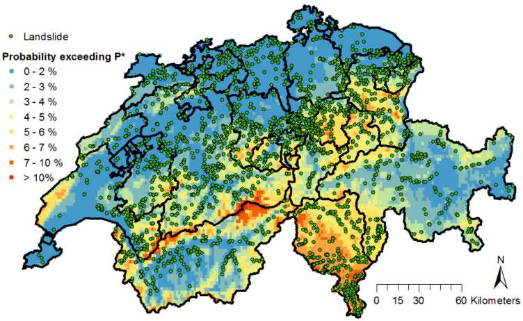
The triggering of sediment producing events like landslides, floods, debris flows, etc., is usually given by a combination of hydroclimatic factors, land surface erodibility, and the availability of sediment. In this research we investigated the triggering factors of those sediment sources (e.g. landslides by rainfall, fine sediment production by glaciers, snowmelt, and overland flow). We built data evidence for the role of these triggering factors, and what they mean for climate change and natural hazards. We also developed blueprints for natural hazard warning systems based on these concepts.
Projects:
SEDFATE
Landslide.CH
Alpine Rhine S2S