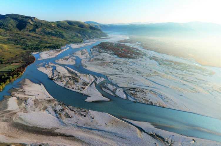
Riparian Zones and Floodplains
Riparian zones around rivers are critical zones for hydrology-geomorphology-ecology interactions and hotspots of biodiversity. Human pressure on alpine rivers by channelisation, damming, and hydropower operation has led to many adverse effects by disrupting the sediment fluxes, reducing aquatic habitat, affecting floodplain forests. In our research we aimed to address these effects with monitoring and physically-based modelling.
Suspended sediment monitoring
Suspended sediment monitoring is important for riverine, coastal and marine ecosystems, nutrient transport, global biogeochemical cycles, water quality and pollution. Suspended sediment monitoring in rivers is extremely difficult and expensive with current technology, and there is a need for smart, affordable, sufficiently accurate, and easily deployable water turbidity sensing for a range of environmental applications. In this research we contributed to the development of new smart turbidity sensing which overcomes problems with traditional sensors, with the specific focus to identify and better understand the physical connections between climate, hydrology, river processes, and sediment fluxes, to explain the variability in SSC and to identify fine sediment sources in catchments.
Projects:
SuspSedSense
Riparian system ecohydrological monitoring
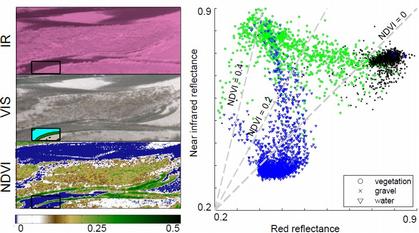
To understand flow interactions within a riparian system requires continuous and concurrent monitoring of hydrological fluxes and state (e.g. groundwater levels, soil moisture, river water levels), climatic variables (e.g. precipitation, temperature, radiation), vegetation state (e.g. NDVI, tree stem radius, sapflow), and aquatic ecology (e.g. macroinverterbrates, fish). We conducted such measurements in the Maggia River where we have established an experimental river site to study flow regulation effects on the river ecosystem. We have derived riparian vegetation erosion patterns from terrestrial photography (MaVal) and conducted plant-scale measurements of water use of Salix species to identify water stress during low flow conditions (HydroEnv).
Riparian vegetation dynamics in the lab, field and model
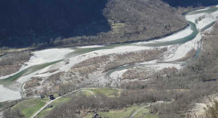
In natural rivers riparian vegetation develops and evolves in tune with the flow regime. Main water stress derives from (a) floods which erode the plants at times when their root systems are not sufficiently strong, and (b) low groundwater levels which lead to dessication of seeds and plant wilting. These two stressors shape the structure of riparian vegetation in space and time on gravel bars and banks of rivers. We have explored the interactions between floods and vegetation in external page flume experiments at the University of Hull, we developed probabilistic models for such interactions (MaVal) as well as physically-based models which combine hydrodynamic modelling with groundwater modelling and dynamic riparian vegetation change (HydroEnv). Wetested such approaches in real river settings, e.g. Maggia River and the Thur River (RECORD).